 A snow-capped mountain near Huaraz
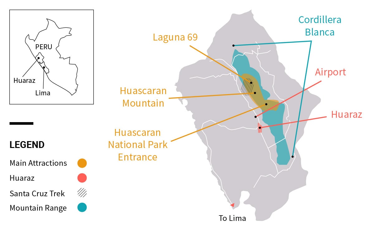
Travelers often say they’re going to Huaraz but the city is more often used as a stopover point before journeying into the Cordillera Blanca – where the real action is.
The Cordillera Blanca is touted as the mountaineering capital of Peru. Its name means White Range which hints at the wonderland of picturesque glacier lagoons and less trodden trails that are amid these snow capped mountains. Here, trekkers, rock climbers, runners, and mountain bikers have access to world-class experiences without mass crowds. Even folks who visit Huaraz and prefer a lighter agenda of day excursions by car with minimal walking are easily overwhelmed by the region’s beauty.
Explore the best attractions and things to do in Huaraz and the Cordillera Blanca. Video produced by Esteban Barrera
Declared a protected natural area by UNESCO in 1985, Huascaran National Park safeguards 340,000 hectares of the Cordillera Blanca. It’s home to more than 27 mountains above 6,000 meters but none surpass the soaring 6,768 meter (22,205 feet) summit of Mount Huascaran – Peru’s highest peak. Alongside rugged mountains are turquoise lakes, deep ravines, glaciers, and a diversity of vegetation types. With some luck you may spot local wildlife favorites like vicunas or Andean condors .
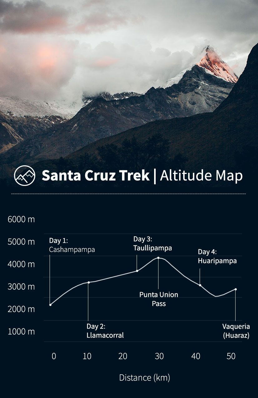
Glaciers clinging to jagged mountaintops, piercing turquoise lagoons, and grazing herds of alpacas amid river ravines are around every bend of the Santa Cruz Trek. These striking landscapes are no doubt why this trek is the most popular option in the Cordillera Blanca. Typically organized on a 4-day/3-night itinerary, the daily walking distances and uphill climbs paired with the high altitudes make the Santa Cruz Trek best suited for people in good physical condition.
Laguna 69 is one of the most recognized day hikes within Huascaran National Park. The uphill journey to Laguna 69’s blue waters backed by snow covered peaks is your picture perfect reward. It takes about 3 hours to arrive to the lagoon, and 2 hours to return.
“I loved this hike! It starts off in a beautiful field with streams and cows before you start going up. All the views throughout the hike were gorgeous and the lake itself was nice and bright blue. This is a hike I’d recommended for active people.” – Rachel W, Travel Advisor
Sandwiched between towering cliff faces, these iconic lakes in the national park sit at the bottom of the Huascaran Peaks. On a sunny day their waters are a dazzling shade of turquoise. Driving into the park, the first Llanganuco Lake of Chinancocha is often dotted with rowboats filled with passengers. The other lake is Orconcocha. Along the lakes’ shores you’ll come across trees with unusually flakey red trunks known as queñua trees that grow in high Andean regions.
Huaraz is likely on your Peru trip planning radar if you’re a person who spends their weekends scaling walls and a lot of free time at the local indoor climbing gym. Accessible from Huaraz are numerous routes for sport climbing and bouldering.
In a region where nature gets most of the limelight, the archaeological site of Chavin de Huantar (near Huaraz) reminds us of the early human civilizations that called these mountains their home. This pre-Inca complex is a UNESCO site that served as a ceremonial and pilgrimage center. The lithic art and symbolic carvings that decorate the plazas and columns are among its most significant features.
At Chavin de Huantar visitors can marvel at the rich history and culture of the Chavín culture , which is believed to have developed from 900 BC to 200 BC. The site consists of a principal pyramid-shaped temple that presides over a large plaza. Walls were constructed from large stone slabs, polished and stacked one atop the other. One of the Chavin site’s most extraordinary facets is the abundance of stone art – carvings, sculptures, pottery , and tenon heads – decorated with plant, animal, and human motifs. Depictions of jaguars, monkeys, serpents, eagles, and caimans are common.
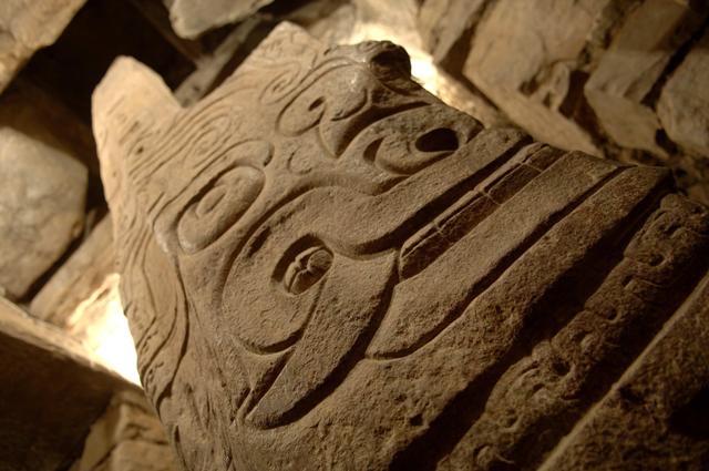
The Lanzón Stela at Chavín pierces through the gallery ceiling. Photo by Lacey Nutting.
Beneath the pyramid structure is an enigmatic maze of underground passageways with a single entrance. Small ducts circulate air into the tunnels and transmit sun beams from the outside, creating plays of light and shadow on the carved iconography of the gray stone walls. The passages also display remarkable acoustics ; the sound of water rushing into the temple via small canals becomes amplified and replicates the roar of a jaguar. Most thrilling of all is the Lanzón de Chavin , a knife-shaped stone monolith carved with the figure of an anthropomorphic god with a feline mouth and a head of snakes.
First excavated by the famed Peruvian archaeologist Julio C. Tello in the early 1900s, Chavin retains many of its mysteries. The ruins feature a museum which boasts a number of original artifacts, but many have been taken to museums in Lima and replicas put in their place.
The Huayhuash mountain range neighbors the Cordillera Blanca in Peru. Noted as one of South America’s premier multi day treks, the Cordillera Huayhuash Circuit is packed with high mountain passes, glacial lagoons, hot springs, and remote villages. The 8 to 14 day itinerary for the Huayhuash Circuit – frequently compared to trail routes in Nepal – is far more demanding than the classic 4-day Inca Trail to Machu Picchu in southern Peru. Most people organize their Huayhuash expedition from trekking providers based in Huaraz.
Each year a growing number of events bring runners to the Cordillera Blanca. These include the 45K Sierra Andina Chavin Trail and the Sierra Andina Mountain Trail.
The Cordillera Blanca is home to some of the highest tropical glaciers in the world. In total, the range tallies over 700 glaciers, and one of these ice masses is Pastoruri. Like many destinations within Huascaran National Park, Pastoruri resides in a very remote location and there is no direct public transportation to get there, so the best way to reach the glacier is by tour.
Learn more about the Santa Cruz Trek, one of the most popular treks near
Huaraz.
Violeta from Chavin Tours in Huaraz answered some common questions about the Santa Cruz Trek:
Why is the Santa Cruz Trek so popular in Huaraz?
The Santa Cruz Trek takes you to beautiful areas full of nature. The trek follows a path with breathtaking views, quenual forests, lagoons, rivers and other attractions of the Santa Cruz ravine.
What are unexpected highlights along the Santa Cruz trail?
Definitely all the spectacular views of the Cordillera Blanca. It’s breathtaking!
What is the most challenging day of the trek? Why?
The third day is the most difficult one as the highest point of the trail goes over a mountain pass of 4,750 msnm. High altitude trekking is always a challenge!
The Santa Cruz Trek is best suited for what type of outdoor lover?
The Santa Cruz Trek is one of the best in the region and is suited to trekker in good physical condition. Training in advance is a must as it’s a high altitude trek. There is also others good treks such as Cedros Alpamayo and Huayhuash that are also challenging!
The most publicized hikes are located on the North side of the Cordillera Blanca approximately 60 to 100 km (37 to 62 mi) from Huaraz , a town that serves as the region’s home base for climbers, hikers, and other outdoor adventurers. Typically, any given hike takes around 2.5 to 3.5 hours one way of travel time to reach the trailhead, equating up to a 10 to 12 hour day. Time and distance combined with large numbers of people to popular areas during high seasons, take away from the beauty and silence of the mountains.
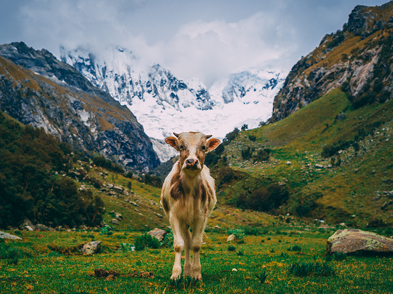
A great benefit of the southern side of the Cordillera Blanca is the access from Huaraz . Travel time to the trailheads take between 45 minutes to 2 hours of driving one way, and there is minimal to no tourists. There you will find day hikes that are equal in beauty to the northern hikes in terms of the glaciers and lakes that make the Cordillera Blanca unique. Below we share 3 of our favorite hikes on the southern side of the Cordillera Blanca (that you probably haven’t heard of): Laguna Rajucolta, Quebrada Shallap, and Quebrada Llaca.
This is a good day hike for acclimatizing as the lake sits about 250 m (820 ft) lower than most lakes in the Cordillera Blanca, the hike is shorter than most and it’s a gentle incline from the trailhead gates to the lake, making it a great acclimatization hike.
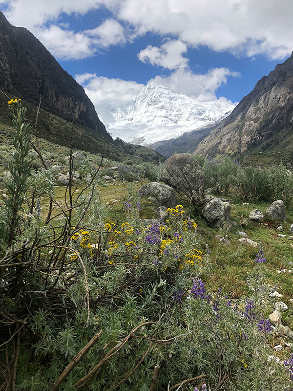
The added bonus is there’s never many hikers and you are rewarded with a crystal blue lake cradled under the towering Nevado Huantsan which boasts an impressive height of 6,395 m (20,984 ft) and is the 2 nd highest mountain in the Cordillera Blanca. While it requires more driving than the other two hikes, the payoff is driving by the massive Puya Raimondis , the largest bromeliads in the world, right off of the road, past the indigenous village of Macashca.
Trail Stats: Rajucolta
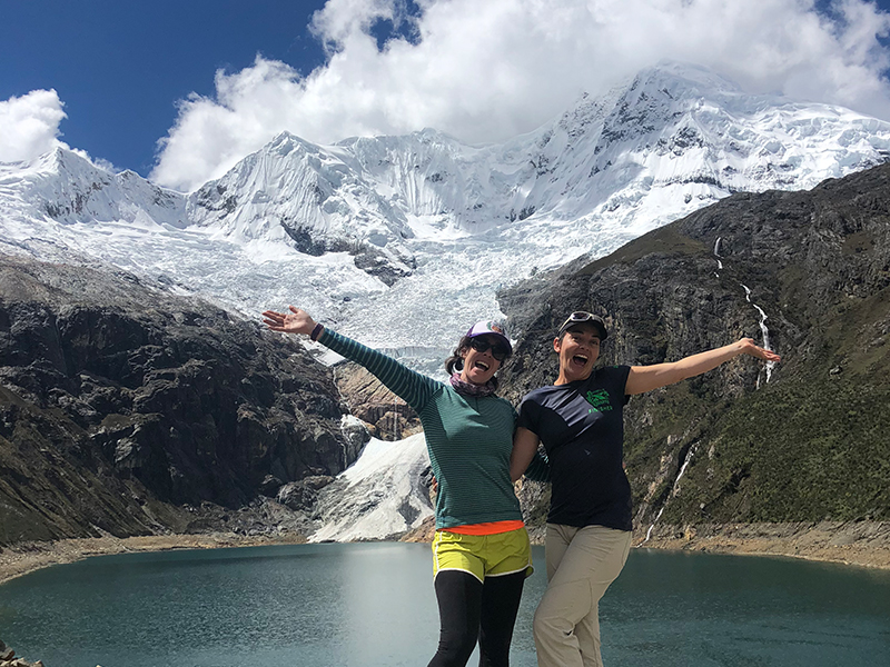
Quebrada Shallap is a great day hike for people that are still acclimatizing but would like to experience Huascaran National Park and its iconic lakes. This can also be a great option for older or younger trekkers that need a gentler ascent with a lake at a lower elevation , as Lake Shallap is almost 250 m (850 ft) lower than other lakes in the area.
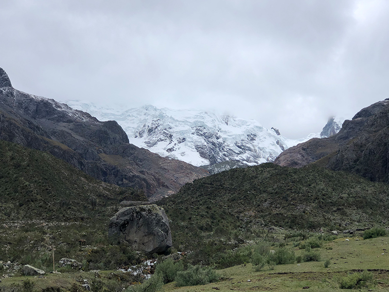
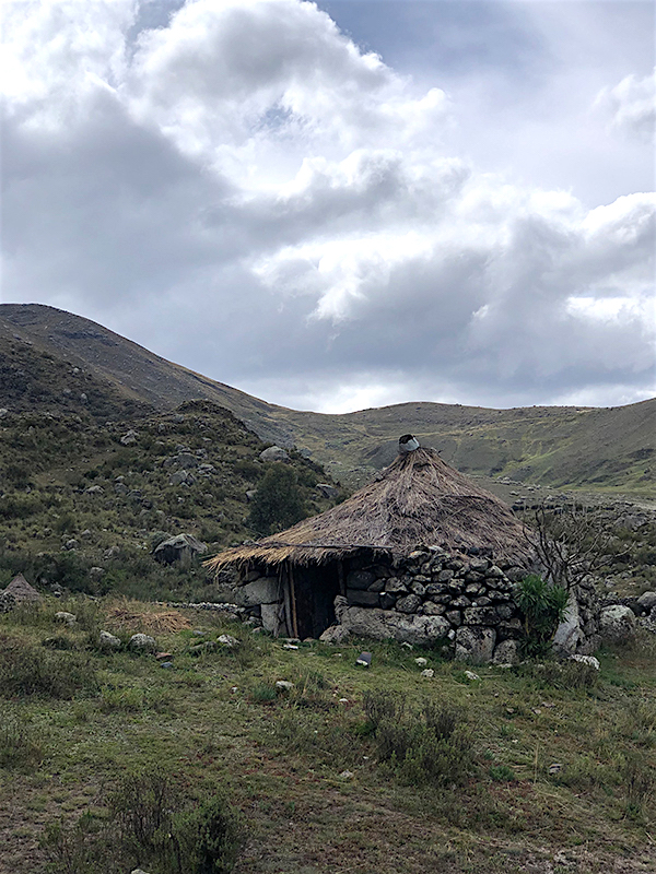
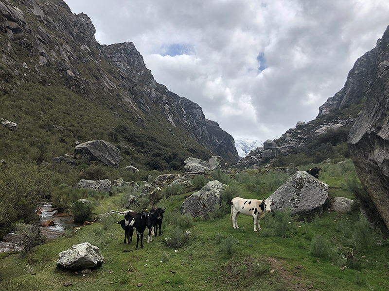
While hiking through the mounds of the valley you will find chozas, traditional resting huts, and frequently see the local indigenous people in large skirts and tall hats tending their fields. Typically you won’t find any tourists in the area and only the Quechua speaking locals.
The valley is filled with large boulders the size of whales , in fact the word “Shallap” is the Quechua word for place of boulders. As the trail flattens out into a meadow you have panoramic views of the area peaks, the largest is San Juan looming an impressive 5,780 meters (18,963 feet) overhead. This hike is also known for a large cave you can explore when ascending the scree field to the lake.
Trail Stats: Quebrada Shallap
Llaca Valley is one of the most under-used hikes and lakes on the southern side of the Cordillera Blanca and is characterized by a celestial blue glacial lake surrounded by the three glaciers : Oshcapalca, Ranrapalca and Vallanaraju.
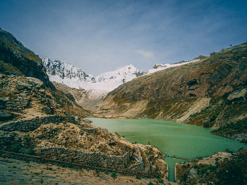
Llaca is one of the few hikes that allows you to get close enough to the glaciers to notice their sounds and movement , which can be very ethereal. In the Llaca Valley you also find a dense forest of endangered Polylepis trees which serves as a habitat to birds that are rare in the area, such as the Giant Conebill and the Pied Crested Tit-Tyrant to name a few.
Years ago a road was built to facilitate building a dam to help control the lake level as the melting of the glaciers created a surplus of water. After the road was built the park service built a refugio in hopes it would bring more climbers, but it hasn’t happened. Currently the refugio is rarely open to the public and is used by the Casa de Guias (a local guide association) for large group climbing courses, wilderness first aid courses and training exercises for the Peruvian military for outdoor rescue. The road is hardly used due to its rough condition and currently the only traffic you’ll find are hikers or climbers that are headed to the base camps to climb one of the surrounding peaks.
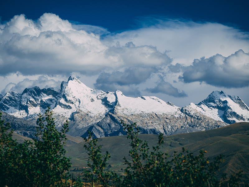
Southern Cordillera Blanca Photo by Rebecca Hollman and François Haché
Trail Stats: Llaca
Llaca Trail Bonus, For Serious Trekkers
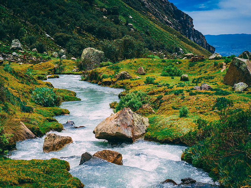
If you want more of a challenge, you can add a hiking loop to the Vallunaraju Base Camp where you can gain an additional 400 m (1,300 ft) in elevation then descend through the adjacent valley coming out next to an indigenous community called Uquia. This add-on offers two more high glacier lakes and sweeping views of Ocshapalca, Ranrapalca, and Vallunaraju glaciers.
Huaraz is the capital of the Ancash Department of Peru and home to some
119,000 residents (2017, source). The city hosts a handful of attractions,
restaurants, and hotels that are within walking distance of the Plaza de
Armas or a taxi ride away.
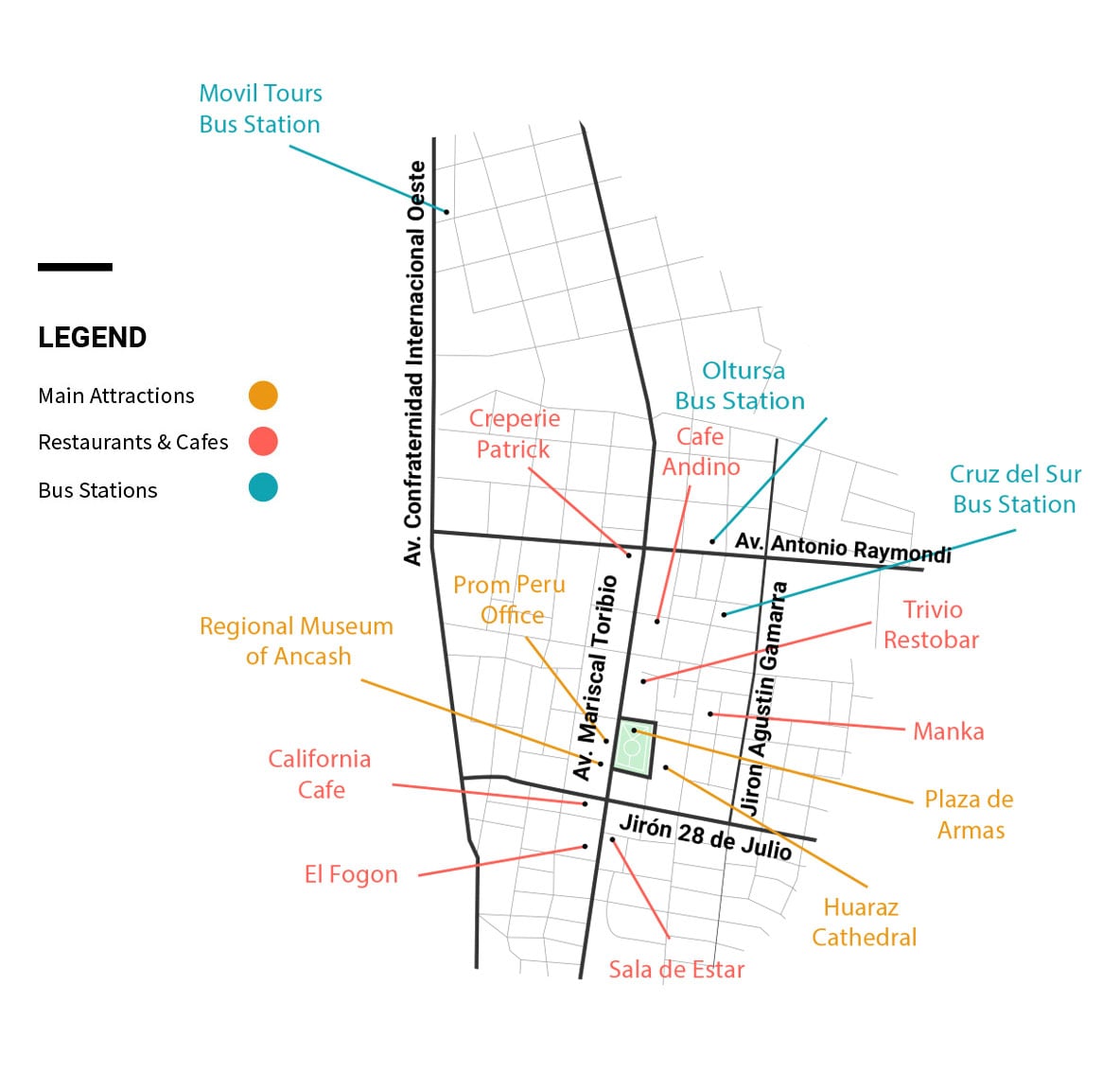
The food served here is varied, from classic Peruvian favorites to sandwiches and some veggie options. Charming decor with a fireplace and chill music greet you at the door. Go up to the second floor balcony for a nice view.
Address: Jirón Lucar and Torre 530, Huaraz
Facebook
This cozy cafe is the spot in Huaraz to enjoy North American style breakfasts and international dishes for lunch and dinner. Complement your meal with homemade bread, speciality coffee, or fresh juice. Check out the selection of books in the cafe’s sharing library.
Address: Av. 28 de Julio 562, Huaraz
Facebook
This restaurant’s speciality is in its name. Order from an extensive list of savory and sweet crepes. More filling options include pepper steak, chicken dishes, and classic Peruvian meals.
Address: Av. Luzuriaga 422, Huaraz
Facebook
Founded in 1997, this dining establishment has a Novoandino menu with meat specialities like pollo a la brasa and anticuchos served with a side of fries. Open for lunch and dinner.
Address: Av. Mariscal Toribio Luzuriaga 928, Huaraz
Facebook
An Italian restaurant with a Peruvian twist and other traditional dishes. Enjoy handmade pasta in various sauces or a classic lomo saltado.
Address: Calle Juan Bautista 840, Huaraz
Facebook
Come for sourdough artisan pizzas and artfully presented tapas served on home baked papa amarilla (yellow potato) bread. The menu is filled with vegetarian-friendly options.
Address: Mariscal Toribio de Luzuriaga 923, Huaraz
Facebook
Order the locally brewed Sierra Andina beer on tap with a casual meal. Burgers, Thai soup, and fettuccine alfredo are on the wide-ranging menu.
Address: Av. Luzurriaga (block 6) – Parque del Periodísta,
Huaraz
Facebook
In and around the city’s main plaza, backpacker hostels and no frills hotels are the norm. These accommodations are particularly enticing to budget travelers or someone planning a brief overnight stay close to the bus station.
Staying at a comfortable lodge away from the bustle of the city is a wonderful opportunity to maximize your contact with nature. Book a few nights to take it easy while adjusting to the high altitude before a trek, or stay after your adventures in Huaraz to enjoy the mountain scenery at a slower pace.
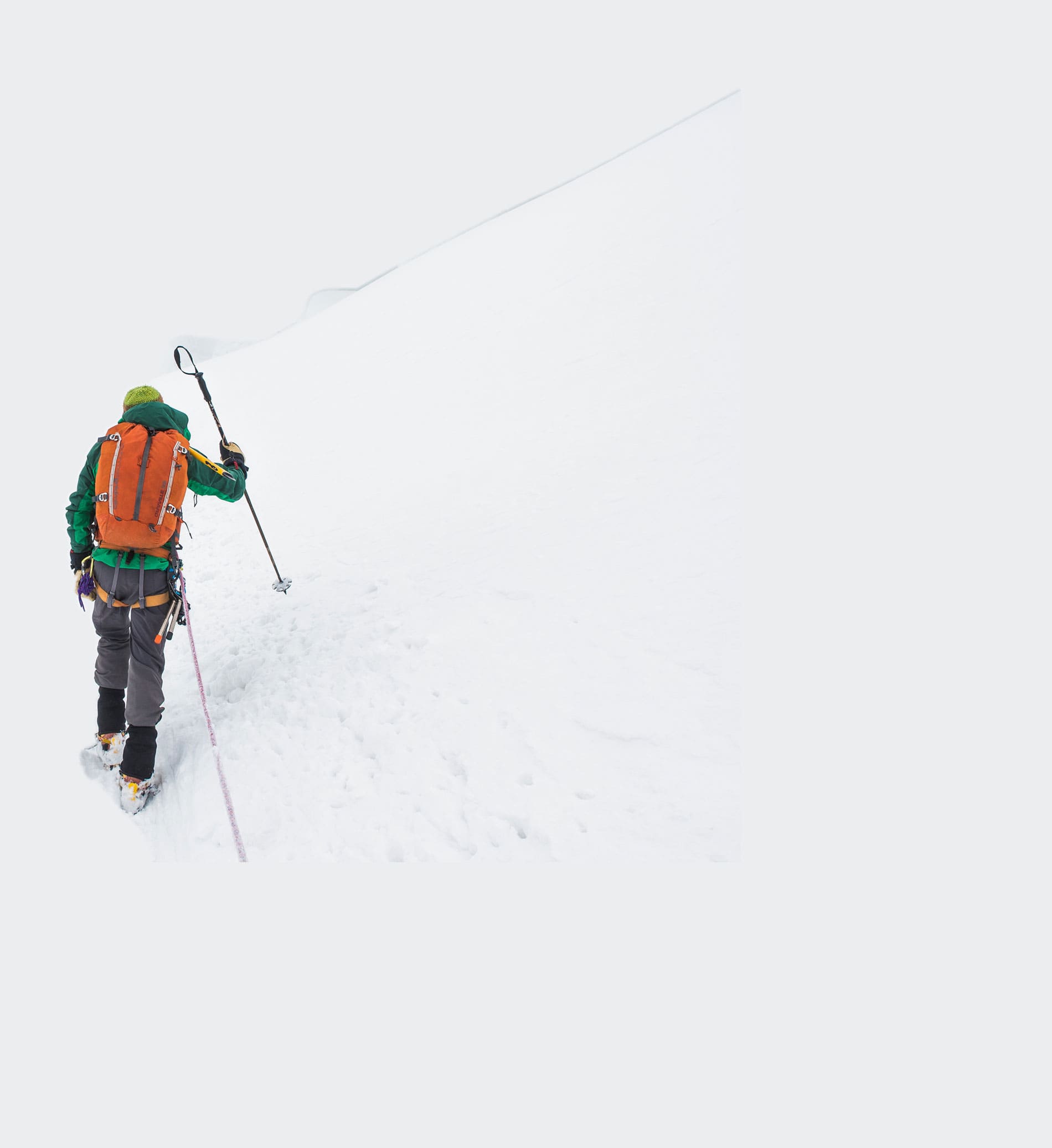
Follow this essential info and advice for planning your trip to Huaraz.
Take the bus, fly, or drive to Huaraz from Lima. The city of Huaraz is the region’s main transport hub.
Bus travel is the easiest and most affordable way to get from Lima to Huaraz. Daily departures also permit more trip planning flexibility if you don’t know your desired travel dates far in advance.
Cruz del Sur, Movil Tours, and Oltursa are reputable bus companies that offer comfortable service to Huaraz. Upgrading your ticket to VIP generally includes a fully reclinable seat, a personal TV screen with entertainment, and meal/snack service. Travel Tip: Take the overnight bus to Huaraz. That way you arrive to Huaraz early in the morning between 6 to 7 am and can maximize daylight hours to acclimate and soak in the region’s beautiful scenery.
The 45-minute flight from Lima to Anta Airport in Huaraz is the most time efficient transport. Flights are best booked from May to September during the dry season months. Inclement weather may delay flights or cancel them altogether during the rainy season. Update: As of 2020, flight service is not available to Huaraz. Contact Peru for Less for help planning your trip to Huaraz and up-to-date transport details.
The journey from Lima to Huaraz in your own transport takes approximately 5 to 6 hours. Traveling during the daytime is advised due to the curvy road conditions and limited phone coverage in the mountains.
The Servicio Nacional de Áreas Naturales Protegidas (SERNAP) of Peru manages
entrance fees for Huascaran National Park.
 Note: The entry fee may or may not be included with the
price of your trek or tour. Payment for entry to Huascaran National Park
needs to be paid in soles cash.
Soaring elevations of 9,840+ feet (3,000+ meters) greet you in Huaraz and the Cordillera Blanca. Monique, our general manager at Peru for Less, shares her advice for adjusting to the altitude:
“In Huaraz, most activities start early in the morning (especially treks) so try not to cram too much in; your body will already be dealing with altitude and the long bus ride from Lima.
Acclimatization in Huaraz is more key than Cusco, arguably. Why? I arrived super tired from the bus ride, so the combination of little sleep plus higher altitude meant I was out of it for the first day completely. In general, this is a region for doing more outdoor and adventure activities so you want to make sure you’re feeling as good as possible.
Ideally, arrive at least 2 days before starting any rigorous activity. Don’t have anything planned for the first day you arrive, and on the second day consider doing one of those van tours. Lago Llanganuco was great, for example, with several stops and a modest amount of walking. Don’t feel guilty about taking it easy!”
Don’t forget to pack these essential items for your trip to Huaraz:
Travelers going to Huaraz are encouraged to book services with credible companies to receive quality service, professional guides, and security. Our Peru for Less travel advisors are happy to help out with trip planning and answer your questions.
Alternatively, if Huaraz is a leg of your Peru trip you’re planning on your own, be sure to ask around for recommended trekking and excursion providers. Not all tourism services are the same and super low pricing may be a cautionary flag of cutting industry standards or lacking proper certification.
Contact Peru For Less for help planning your trip to Huaraz.



Email: [email protected]
Sign up to receive our newsletter for great articles, stunning photos, and special deals.